
We have 26 guests and no members online
DISTRICT STATISTICS based on the Labour Force and Household Living Conditions Survey 2018-2019
DISTRICT STATISTICS
(based on the Labour Force and Household Living Conditions Survey 2018-2019)
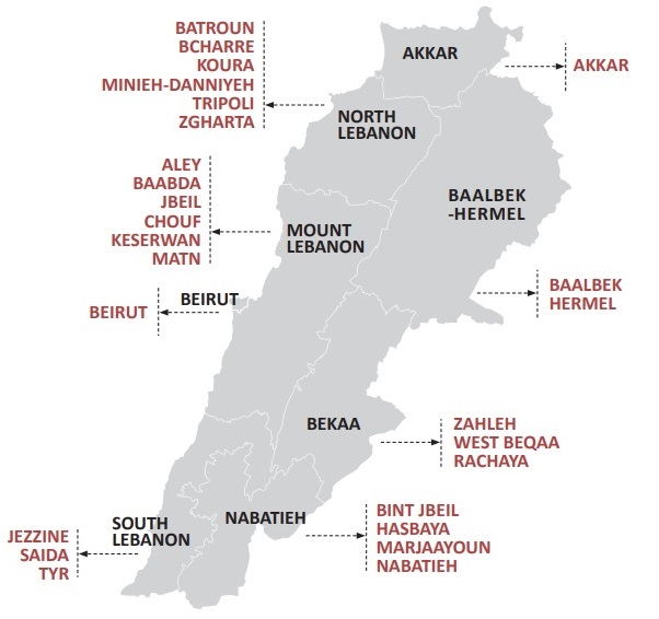
CAS presents district-based statistical reports, prepared in collaboration with the UNDP, covering the 26 Lebanese administrative districts. These reports are drawn from the findings of the LFHLCS carried out by CAS between 2018 and 2019, and provide a description of the socio-economic context in each district. The covered districts are illustrated in the map below.
إحصاءات الأقضية
(مسح القوى العاملة والاحوال المعيشية للأسر 2018-2019)
أطلقت إدارة الإحصاء المركزي بالشراكة مع برنامج الأمم المتحدة الإنمائي 26 تقريرًا إحصائيًا باللغتين العربية والانكليزية تغطي الأقضية اللبنانية
هذه التقارير تستند إلى نتائج مسح القوى العاملة والاحوال المعيشية للأسر التي قامت به إدارة الاحصاء المركزي بين عامي 2018 و2019، وتوفر هذه التقارير بيانات إحصائية لفهم السياق الاجتماعي والاقتصادي لهذه الأقضية
تم عرض كافة الاقضية اللبنانية في الخريطة أدناه
 |

 |
|
Central Administration of Statistics
Residence of the Council of Ministers, Badaro, Beirut, Lebanon
|
